

Tuesday, September 27, 2011
Sunday, September 25, 2011
Chamba Himachal Pradesh,India -Information and Photos
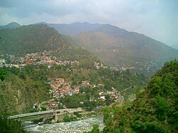
Though historical records date the history of the Chamba region to the Kolian tribes in the 2nd century BC, the area was formally ruled by the Maru dynasty, starting with the Raju Maru from around 500 AD, ruling from the ancient capital of Bharmour, which is located 75 kilometres (47 mi) from the town of Chamba.In 920, Raja Sahil Varman (or Raja Sahil Verma) shifted the capital of the kingdom to Chamba, following the specific request of his daughter Champavati (Chamba was named after her). From the time of Raju Maru, 67 Rajas of this dynasty have ruled over Chamba until it finally merged with the Indian Union in April 1948, although Chamba was under British suzerainty from 1846 to this time.
The town has a large number of temples and palaces,and hosts two popular jatras (fairs), the "Suhi Mata Mela" and the "Minjar Mela", which last for several days and involve music and dancing. Chamba is also well noted for its arts and crafts, particularly its Pahari paintings, which originated in the Hill Kingdoms of North India between the 17th and 19th century and its handicrafts and textiles.
Chamba Himachal Pradesh,India -Information and Photos |
| The Ravi River flowing through Chamba |
 |
| Panorama of the upper part of the town and mountains surrounding it |
 |
| View of Chamba Town |
..jpg/200px-Gopal_Singh,_Raja_of_Chamba_(ruled_1870-1873)..jpg) |
| Gopal Singh, Raja of Chamba (ruled 1870-1873) |
 |
| Laxmi Narayan temple in Chamba |
 |
| Chamba, Himachal Pradesh |
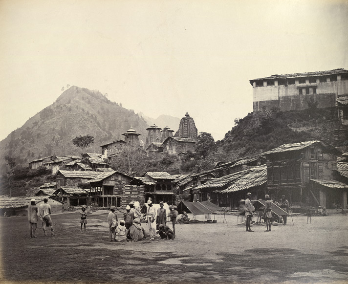 |
| Chumba. Bazar & Temples in 1860 |
 |
| Chamba, Himachal Pradesh in 2009 |
 |
| Chamba from across the river, Himachal Pradesh. |
 |
| View of Chaugan at Chamba |
 |
| Bhuri Singh Museum. Chamba, Himachal Pradesh |
 |
Description =Varaha avtar of Vishnu, killing a demon to protect the Earth, and the earth goddess, Bhu or Bhu devi, which he lifts on his tusks above the black ocean. c1740. gouache on paper. probably Chamba, Pahari region, north India.( Date;c1740) |
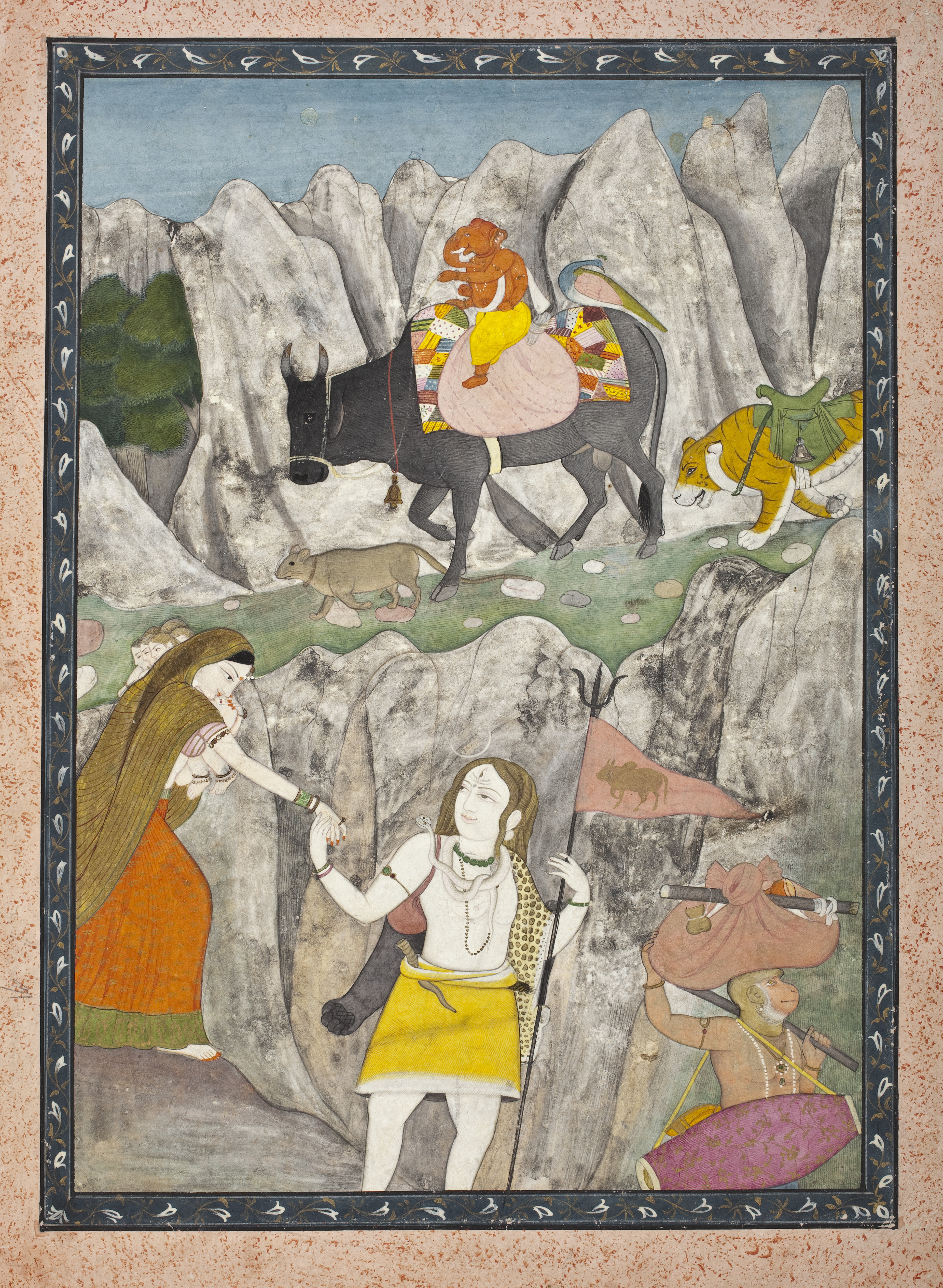 |
| Pahari painting of Chamba dated 1800– depicts godShiva’s Family on the March. |
 |
| The Chaugan in Chamba, where fairs are held |
 |
| Bridge on Budhil River Manimahesh Lake Chamba Himachal Pradesh |
 |
| chamba himachal pradesh map |
 Posted in:
 Top Ten Most Rainiest Places in the world
1# Crkvica, Bosnia and Herzegovina

Although the country of Bosnia and Herzegovina is devoid of coastline, save for a scant shore of the Adriatic, it nonetheless receives a fair amount of rain, most notably in Crkvica.

The town in Bosnia, just northwest of Sarajevo, consistently receives the highest annual average precipitation in Europe. So much for London’s reputation.
2# Henderson Lake, British Colombia, Canada

People who live outside of British Columbia in Canada, especially those in Toronto and Montreal, where long winters are the norm, love to chide residents of the province for their temperate but rainy climate.

There is no small amount of jealousy behind the tactic, because not only is Vancouver – the main city in British Columbia – a beautiful place to live, it also happens to be the only place in Canada where one can golf in February. However, the rain is not just a cliche here, but a meteorological reality. Just ask residents of Henderson Lake.
Stay dry in beautiful Vancouver with a great hotel deal.
3# Andagoya, Colombia

We seldom think of Colombia as a country so pluvial but it does in fact have several climactic challenges that pose real threats. In fact, the country is a world rarity, in that it belongs to a select few with a classification as megadiverse. This superpower-like designation insinuates that Colombia, because of geographic position, has crazy weather fluctuations.

Indeed, with five natural regions that include high mountains, tropical deserts and steppes, the rainy season here is notorious. The town of Andagoya, with a position smack dab on the thermal equator, has a temperature that rarely shifts more than a few degrees from month to month and in turn, receives torrents of rain.
4# Bellenden Ker, Queensland, Australia

Another megadiverse country, perhaps more so than any other on the planet, is Australia. With desert, mountains, ocean and tropical rainforests, the country continent is unlike any other.

The area of Bellenden Ker and indeed, the mountain of the same name, is a World Heritage Rainforest zone. A short drive from the city of Cairns, the region is lush, rife with exotic plant and animal life and indeed a victim of mass precipitation.
5# Quibdo, Colombia
Colombia proves to be wet all over once again with the town of Quibdo. Over 100,000 people live in the capital of the Choco Department, as the national divisions are known as. On the border of Panama and indeed, the gateway between South and Central America, the department and town receive some of the most zany weather in Colombia.

Unfortunate because in addition – or perhaps because of which – Quidibo has some of the worst social conditions and economic track records in the country. In point of fact, despite record rainfall every year, the lowland town still manages to suffer from water shortages.
6# Debundscha, Cameroon

Cameroon has a reputation for being one of the most exotic and beautiful nations in Africa. Indeed, it encompasses the principal features of the continent on a small scale, with hyper diversity in a region about the size of California. As a result of course, parts of Cameroon receive super heavy rainfall.

This tends to be the case when you have ocean coastline, tropical forests, grasslands, deserts and mountains within close proximity to each other. At the base of Mount Cameroon and within plain view of the Bight of Biafra, Debundscha receives over 400 inches of rain a year.
7# Cherrapunji, India

Another region with rainfall levels well above 400 inches, Cherrapunji shares another notorious distinction with other wet areas. In utter bewilderment and stark contrast to the weather, the town in the state of Meghalya confronts epic water shortage problems.

Geography conspires to make Cherrapunji so wet and also devoid of potable water by the same token. At the confluence of the Kashi Hills and Bay of Bengal, the town receives both north and south monsoon showers that pound the area in a flash, only to flood down the plains of Bangladesh. No suprise then that Cherrapunji holds the record for most rainfall in one year at over 900 inches back in 1860-61.
8# Mount Waialeale, Kauai, Hawaii, United States of America

Although not exactly a residential area, the region around Mount Waialeale and indeed the summit, receives a ton of precipitation on a habitual basis. Tourism officials in Hawaii love to boast that this is the wettest place on the planet, although some in India and Colombia take issue with the claim.

Whatever the case may be, the rainfall in Kauai is notable for the fact that it occurs with such daily regularity. Mount Waialeale bears the brunt of the precipitation because of a conical shape and pure geographical position relative to the ocean and trade winds. Although open to tourism, there are obvious physical impediments here due to the amount of rain that falls every day. In other words, the ground is super wet.
9# Mawsynram, India

Another village in the Kashi Hills in the state of Meghalya, Mawsynram proves once again that India is a complex and diverse country. A quick drive from Cherrapunji, the town records indicate more annual rainfall, although disputes about data accuracy have been rife as both regions fight for rainfall supremacy.

Whatever the case may be, Mawsynram appears to have a more favorable – or is that cursed? – position in terms of proximity to the Bay of Bengal and steep incline of the Kashi Hills, which allows humid, moist air to ascend and in turn, blanket the area with rain.
10# Lloro, Colombia
 |
The town and municipality of Lloro is another area within the Choco Department of Colombia prone to rain. A lot of rain. With coastlines on the Pacific and Caribbean, unique in the country, the area is an ecological freak of sorts and as a result, the victim of zany phenomena. Average annual precipitation in the town of Lloro is 523.6 inches, which ranks it first in terms of wet world zones. With over 7,000 inhabitants, one has to wonder how people here cope with almost 1.5 inches of rain a day.
 |
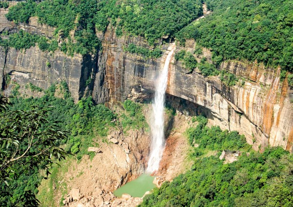
Cherrapunji - The Rainiest Place On Earth, India
 |
| Cherrapunji - The Rainiest Place On Earth, India |
 |
| Shillong, Cherapunzi (rainiest place on theEarth) , Kajiranga National Park |
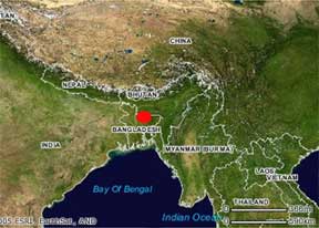 |
| Map Of Cherrapunjee- The Raniest place In the World |
Cherrapunjee
1300 m above sea level, known all over the world as the rainiest place on the planet.
Cherrapunjee is 160 km from Guwahati.
 |
 |
Tuesday, September 20, 2011
 |
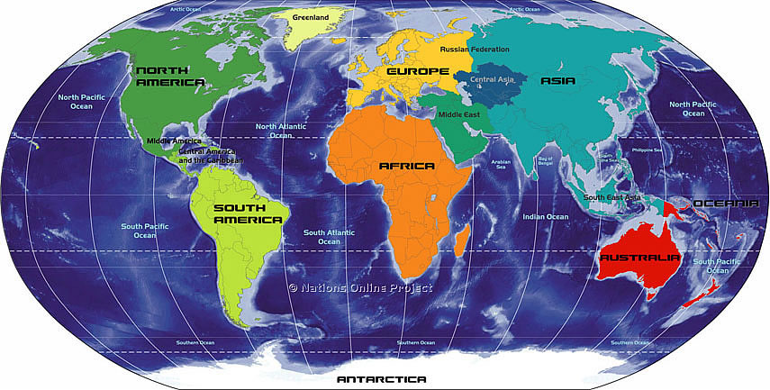
| Map of Continents |
 |
| Map of Continents |
 |
| Map of Continents |
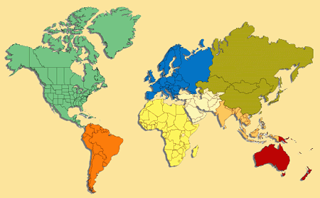 |
| Map of Continents |
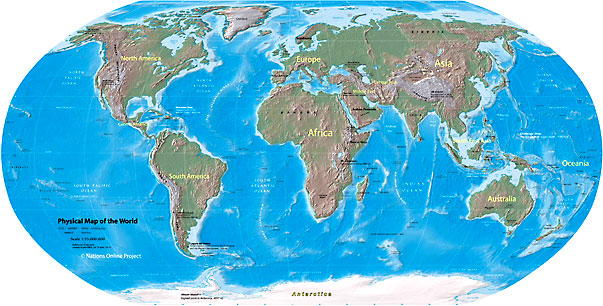 |
| Map of Continents--Physical Map of World |
 |
| Map of Continents and Countries |
A continent is one of the main large land masses on Earth. Since the shape of the Earth`s land mass is not simple, continents are not identified by any strict criteria but rather by conventional classification. Some pieces of land, of course, are not attached to any major continental land mass but they are categorized as part of nearby continents. Therefore Iceland is considered part of Europe, Madagascar is part of Africa, Japan and Phillipines are in Asia, etc.
The region of Oceania is largely considered to be part of the continent of Australia, while the Malay archipelago is considered part of Asia. These classifications, however are far from being simple or universal.
Canada Map Images
 |
| Canada Map Images |
 |
| Canada's Map Image |
 |
| Canada's Cities Map |
 |
| Canada Provinces and Cities Map |
 |
| Detailed Map Of Canada |
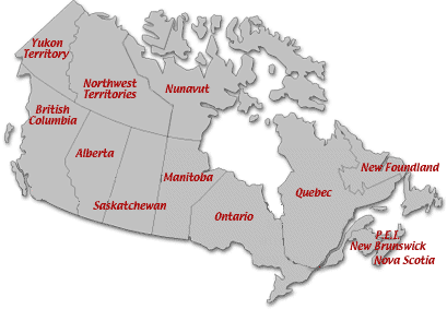 |
| Canada's Political Map |
 |
| Canada's Physical Map Image |
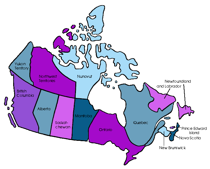 |
| Canada's Provinces & Territories |


